Students are working on the following objectives for social studies and science.
The student will use geographic research to gather and process information to interpret, solve problems, and construct maps.
The student will name and locate specific regions, states, capitals, river systems and mountain ranges in the US based on historical and current topics.
Describe and analyze the physical and human characteristics of the region.
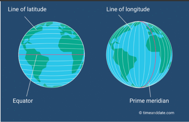
Students reviewed latitude and longitude before starting the research!
Students will be constructing a map including the following:
On the USA map independently complete the following in pencil first.
|
Checklist
|
|
Outline the states in your region.
|
|
Label the state names in your region.
|
|
Label the city names in your region and identify with a STAR.
|
|
Include the most important river system in your region. (Consult a map or atlas) Draw it in the region and label it.
|
|
Include any mountain ranges, using the appropriate symbol and label.
|
|
Create a key to the map in the lower corner and be sure to consult a map or atlas to represent it correctly.
|
|
Identify and label the following on your map after you consult a map or atlas:
|